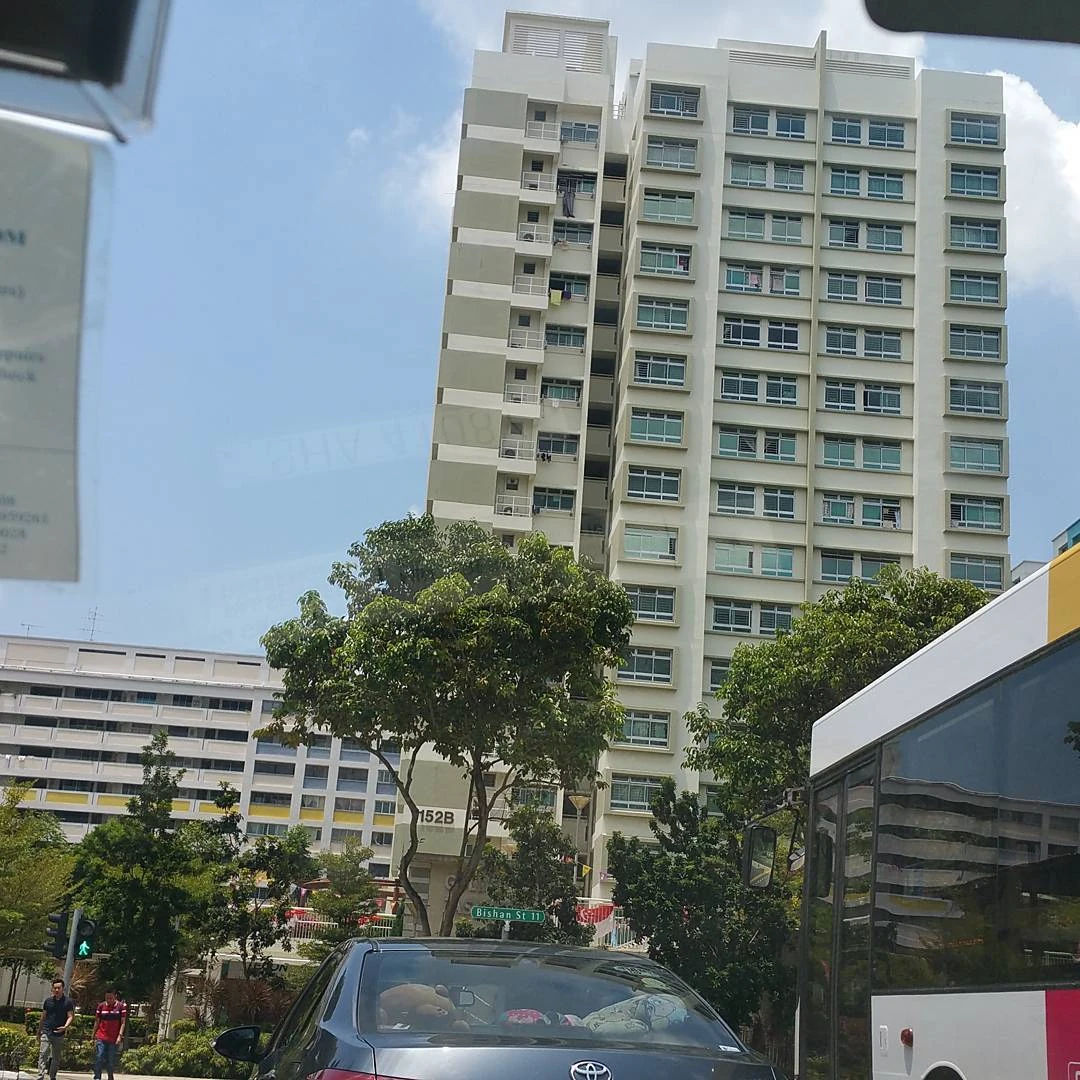
Bishan East
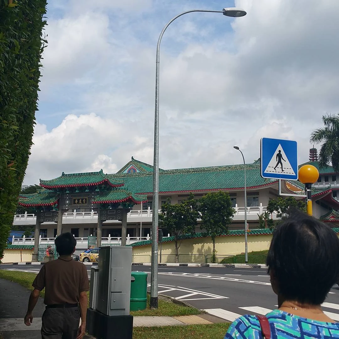
Tse Tho Aum Temple

The Children's Clinic
Bishan Template:IPAc-en (Template:Zh, Template:Lang-ta), also known as either Bishan New Town or Bishan Town, is a planning area and matured residential town located at the northernmost portion of the Central Region of Singapore. Statistically, the area is ranked the 38th biggest in terms of geographical size and the 21st most populated planning area in the country.[1] This however, makes Bishan ranked 15th in terms of population density.[2] Apart from its boundary with the Central Water Catchment in the west, Bishan borders three other planning areas - Ang Mo Kio to the north, Toa Payoh to the south and Serangoon to the east.
What is now Bishan today was once land that belonged to Kwong Wai Siew Peck San Theng, a cemetery that mainly served the Cantonese and Hakka communities of Singapore. Following the establishment of the cemetery in 1870, the first human settlements began to appear in the area, forming what eventually became Kampong San Teng.[3][4] During the Battle of Singapore in 1942, Peck San Theng was the site of a fierce firefight between the invading Japanese forces and the defending British.[3][5] The subsequent fall of the island to the Japanese that same year eventually made Peck San Theng a place of refuge for most of the Singapore population.[6] In 1973, Peck San Theng stopped accepting burials and six years later following a government lease, land was acquired for development.[7] Graves were then exhumed between 1982 and 1984 paving the way for the construction of Bishan New Town in 1983.[3] Today, Peck San Theng still remains in operation, although it had since been converted into a columbarium.
Bishan New Town became the first in Singapore to depart from the brutalist design seen in most previous Housing and Development Board (HDB) towns. Instead of slab-like residential blocks that were built in uniformed rows, apartment blocks in Bishan varied in height and were often dislocated. Flats within the town also featured pitched roofs which have since become closely associated with the skyline of Bishan.[3][4] The town is also home to two of Singapore's most prestigious educational institutions, Catholic High School and Raffles Institution.[4][8]
Etymology[]
Bishan derived its name from the Cantonese term for large burial ground, Peck San Theng (Template:Zh), which literally translates as "pavilions on the green".[9][10] This term reflects the neighbourhood's origins as a burial ground that was established in 1870 by Cantonese and Hakka immigrants.[3] This burial ground has since been redeveloped and the original graves were relocated to the nearby Peck San Theng Temple.[3]
Geography[]
Bishan Planning Area[]
Bishan Planning Area, as defined by Singapore's Urban Redevelopment Authority is situated in the Central Region of Singapore, bounded by planning areas of Ang Mo Kio to the north, Toa Payoh to the south and Serangoon to the east.
Bishan New Town sits within this planning area.
Subzones[]
As defined by the Urban Redevelopment Authority, Bishan Planning Area is divided into 3 subzones:
| Name of estates | Location | Notable structures | Accessibility |
|---|---|---|---|
| Bishan East | Areas along Bishan Street 11, Bishan Street 12 and Bishan Street 13 | Bishan MRT Station, Bishan Bus Interchange, Bishan Community Library, Junction 8 Shopping Centre, Central Provident Fund Bishan Building, Bishan Neighbourhood Police Post, Bishan Stadium, Bishan Swimming Complex, Bishan Sports Hall, Bishan Depot, The Singapore Scout Association, Kuo Chuan Presbyterian Primary School, Kuo Chuan Presbyterian Secondary School, Guangyang Primary School, Guangyang Secondary School, Masjid An-Nahdhah and Ministry of Education Language Centre (Bishan) | Bishan MRT Station and buses |
| Marymount | Areas to the immediate west of Bishan Road | Raffles Institution, Catholic High School, Whitley Secondary School, Marymount MRT Station, Bishan-Ang Mo Kio Park, | Marymount MRT Station and buses |
| Upper Thomson | Western Bishan | Bishan-Ang Mo Kio Park, Thomson Community Club, Bishan Fire Station, Sin Ming Industrial Estate, Bishan Park Secondary School, Peirce Secondary School as well as the future Bright Hill MRT Station and Upper Thomson MRT Station | Buses |
History[]
Peck San Theng cemetery was established in 1870 on the site of present-day Bishan by Cantonese and Hakka immigrants.[3] People began to settle around the cemetery, and Kampong San Theng and Soon Hock Village (which lay within Kampong San Theng grounds),[9] soon grew in size.[3] Singapore Kwong Wai Siew Peck San Theng, a federation of 16 Cantonese clans in Singapore, managed and ran Kampong San Theng.[3] This settlement grew over time to accommodate nearly 2000 inhabitants at the beginning of the 20th century.[5]
During World War II, the Peck San Theng cemetery became a battle ground between British and Japanese forces. The 2nd Battalion of the Cambridgeshire Regiment had engaged the Japanese forces on 14 February 1942 over the nearby strategically important Macritchie Reservoir. The Japanese also bombed Kampong San Teng, which resulted in significant civilian casualties. The battle ended the next day, 15 January, when the British surrendered to the Japanese. At that point, British troops were still holding out along Braddell Road.[5] During the Japanese Occupation of Singapore, this area became a refuge for people trying to evade the Japanese because the Japanese occupiers were afraid to enter the cemetery.[6]
After the war, the graves of Peck San Theng became a known gangster hideout and gang-related crimes became rife in the area.[11][12][13] In 1973, the government ordered the cemetery to be closed and mandated that no fresh burials can be done within the cemetery.[14] The government later acquired this cemetery land from the Kwong Wai Siew Peck San Theng foundation for SGD$$4.95 million in 1979.[15][16] As compensation, the government gave 3 hectares of the land back to the foundation for the foundation to build a columbarium.[16] The foundation subsequently built a multi-story columbarium complex on this land.[17]
In the early 1970s, the Housing Development Board (HDB) built the first housing estate which is located at Sin Ming Road along with clusters of industrial sectors. The first blocks of residential flats were numbered Block 22-26, now known as Sin Ming Ville. Sin Ming industrial estate is also known to be a popular destination for cars and vehicles related matters as the estate houses mainly workshops and establishments specialising in vehicle maintenance and registration.
By the 1980s, the Housing Development Board (HDB) had already begun further expanding the area into a satellite housing estate to meet the rising demand for housing from Singapore's then-growing population.[18] The residents in Kampong San Teng were resettled and a mass exhumation of the 170,000 graves were carried out in 1980.[19] Redevelopment of the area officially started in 1982.[3] On this land, HDB planned to construct 24,600 residential units distributed across 4 distinct neighbourhoods: Bishan East, Bishan North, Bishan West (subsequently renamed Sin Ming Garden Estate in 1988)[20] and Shunfu Estate, of which Bishan East will be the largest.[19]
The first five blocks of housing units were completed by 1985.[19] There were initial fears of a poor demand for houses in Bishan as they had bad fengshui since they were built on a former cemetery.[9] However, the first batch of houses were all snapped out during their launch to buyers who were attracted by the central location of Bishan.[19]
Sports[]
Template:See also
Gymnastics competitions at the 2010 Summer Youth Olympics
Bishan Sports Centre, formerly known as Bishan Sports and Recreation Centre, houses sporting facilities such as a sports hall, a stadium, a dance studio and a swimming complex.[21] Managed by Sport Singapore, these sporting facilities cater to both the general public and professional athletes.[22]
Several major national and international level sporting events has been held at the Bishan Sports Centre, including the 2009 Asian Youth Games and the 2010 Youth Olympic Games.[22] Bishan Sports Hall, which serves as the primary venue for gymnastics competitions in Singapore,[21] has hosted gymnastic competitions as part of the 2009 Asian Youth Games,[23] 2010 Youth Olympic Games[24] and the 2015 SEA Games.[25] It is also the venue for national-level gymnastics competition in Singapore.[26][27] Similarly, the 4,200-seat Bishan Stadium[28] has hosted the athletics and football competitions at the 2010 Youth Olympic Games and the 2015 SEA Games respectively.[24][25]
Bishan Stadium is the home of the Home United Football Club, a professional football club that plays in Singapore's S.League.[25]
Opened in 2008, the Bishan Active park also offers sporting facilities to the residents of Bishan.[29] This 24,000 square metres park houses facilities such as a roller blading track, basketball courts and a beach volleyball court, augmenting the facilities found at the Bishan Sports Centre.[29][30]
Infrastructure[]
Transport[]
Template:See also Bishan is connected by road to the rest of Singapore via the Central Expressway, a major expressway connecting Northern parts of Singapore with its city centre.[9] In addition it has its own Mass Rapid Transit (MRT) station, the Bishan MRT Station, which is an interchange station on both the North South Line and Circle Line.[9] Bishan also has a bus interchange that provides bus services to other parts of Singapore (such as Changi and Punggol).[31] There are also feeder bus services that operate within the neighbourhood.[31]
The Kallang Park Connector, which begins in Bishan, provides a cycling route between Bishan and the Central Business District along the Kallang River. This 10 km route is the first park connector constructed in Singapore.[32]
Bishan Road is a major road in Bishan, Singapore from Ang Mo Kio Avenue 1 to Braddell Road; following the MRT track (Bishan MRT Station and Bishan Depot) are nearby.
Sin Ming MRT Station, a station on the upcoming Thomson-East Coast MRT Line, will link the Sin Ming area of Bishan with the Central Business District of Singapore.[33]
Shopping centres[]
Bishan currently has 7 shopping centres.
- The Junction 8 Shopping Centre, run by CapitaLand, is situated at Bishan Central near the Bishan MRT Station and Bishan Bus Interchange.
- The Bishan North Shopping Mall is a non-airconditioned complex of shops that specialise in the sale of day-to-day products. It features a wet market. Contrary to its name, it is not a shopping mall.
- Thomson Plaza is located on Upper Thomson Road.
- Thomsom V One and Two is a residential complex that comes with a mall featuring shoebox sized retail units on the ground floor and basements.
- Thomson Imperial Court and Sin Ming Plaza, are residential complexes with retail outlets on the ground floor and basement.
- Midview City
An industrial shopping complex located at Sin Ming.
Bishan-Ang Mo Kio Park[]
- Main article: Bishan-Ang Mo Kio Park
The Kallang River at Bishan-Ang Mo Kio Park
The riverine Bishan-Ang Mo Kio Park, is situated near the boundary line between Bishan and Ang Mo Kio, located along the stretch of Ang Mo Kio Avenue 1. The Kallang River which channels through the middle of the park, can be crossed via a number of foot bridges and stepping stones. The park also spots ponds and fishing spots, and serves residents from both new towns.
Bishan Park 1 is smaller in area than Bishan Park 2, and is about 1.7 km in length from end to end. A park-spa has been newly built in this park. This park primarily serves walkers in the morning. Bishan Park 1 is more accessible than Bishan Park 2.
Bishan Park 2 sprawls over a larger area than Bishan Park 1 but is only about 1.1 km in length from end to end.
Education[]
In 1936, the Kwong Wai Siew Peck San Theng foundation established a village school in the former Kampong San Teng to provide free education to the farming families living in the vicinity.[34] The Kwong Wai Shiu Peck San Theng School (广惠肇碧山亭学校) was initially housed on the foundation's temple premises.[35] Starting with 60 students, the school gradually expanded to the point where it started an afternoon session to cater to the demand.[35] The school had to stop classes during the Japanese occupation of Singapore but lessons soon resumed in 1945.[34] In 1957, the school shifted into a new school compound situated at the entrance of a cemetery compound near Upper Thomson.[35] The new school compound had 6 classrooms and could cater to 450 students in two school sessions.[34] The Kwong Wai Shiu Peck San Theng School was also integrated into Singapore's mainstream education system that year.[34] In 1981, due to changes in Singapore's national educational policy, governmental funding to the school was halted and the Kwong Wai Shiu Peck San Theng School soon closed down.[34]
In addition, the current site of the Amtech Building located at Sin Ming Road also used to house another school known as Shin Min Public School (淡申律公立新民学校) from 1945 to 1986, which had closed due to low enrollment.[36]
,_Singapore_-_20100516.jpg)
An aerial view of the Bishan campus of Raffles Institution
Since its redevelopment in the 1980s, Bishan has become home to several educational institutions. According to the Ministry of Education, there are four primary schools[37] and seven secondary schools[38] that are located within Bishan. Raffles Institution, one of the oldest educational institutions in Singapore, has been located in Bishan since 1990.[39] This campus houses both of the institution's secondary and high school sections.[39] There are rumours that Raffles Girls' School will also relocate to the area in the near future.[40] Other notable schools located in Bishan include Ai Tong School, a primary school founded by Chinese pioneers in 1912,[41] and Catholic High School, a Special Assistance Plan school that names Singapore Prime Minister Lee Hsien Loong as one of its alumni.[42]
The prominent schools of Bishan are namely Guangyang Secondary School, Guangyang Primary School, Kuo Chuan Presbyterian Secondary School and Kuo Chuan Presbyterian Primary School.
In addition, at Bishan North, there are Whitley Secondary School of Bishan Street 24, Peirce Secondary School and Bishan Park Secondary School, both of which are located at Sin Ming Ave.
Despite bearing the name Peirce Secondary School, the school was actually a subordinate branch of Bishan Park Secondary School when it first started operating off the latter's campus in 1994.[43]
The Ministry of Education announced Bishan Park Secondary School as one of the schools to be affected by the merger programme. As a result, it is to be absorbed by Peirce Secondary School in 2018.[44]
The Bishan campus of the Institute of Technical Education (ITE) was established in 1994 as part of the government's plan to revamp Singapore's vocational education system.[45] It provided vocational courses in subjects such as accountancy and business.[46] In 2005, this campus became part of ITE College Central during a major revamp of the ITE system.[45] This campus was subsequently closed in 2012 and relocated to the new ITE College Central mega-campus in Ang Mo Kio.[47] The old facilities of ITE Bishan currently serve as a temporary holding site for schools which are undergoing renovation.[48]
In addition to mainstream schools, a campus of the Ministry of Education Language Centre (MOELC), where students get to learn additional foreign languages such as French and German,[49] is located in Bishan.[8] The Singapore branches of the Girl Guides Association and the Scouts Association are also headquartered in Bishan.[8]
It was announced that new school named Eunoia Junior College is expected to be completed at the site of former Nature Park Golf Driving Range located at Sin Ming Avenue by late 2019.[50]
Other than schools ranging from primary to tertiary, there are also nurseries and kindergartens scattered across Bishan estate.
Housing[]
The town is a mixture of three, four and five-room HDB flats. The majority of the flats are four-room-ed, with a few being five and three. Block numbers starting with 1 as the first digit, are generally smaller and more connected with the town center. Blocks numbers with 2 as the first digit, are more spread out and generally larger in size. However, even blocks numbers starting with 2 are further categorised;25_ tend to be the largest flats in the whole estate, with flat sizes ranging from 1650sq feet to 1700sq feet, one of the largest HDB flats in Singapore. Other numbers tend to be smaller and are usually from 1300sq feet to 1500sq feet. Sin Ming Ville (Block 22-26) is excluded from this category.
As is with Serangoon New Town, it was built in an area with a large extent of pre-existing private housing, resulting in a disjointed town layout. The oldest public housing blocks were located around Upper Thomson as housing for the surrounding industrial estate. When the area was designated as a new town, the main housing area was built in the vicinity of Bishan MRT Station, with neighbourhoods built in Bishan North and Shunfu. Newer blocks were also built in Upper Thomson, while the old blocks were refurbished.

Jade Scape
Jade Scape is a condominium in Shunfu, Singapore, that is located at the former HUDC flats at Shunfu. The former HUDC flats at Shunfu were demolished in March 2018, and the completion date is in 2023. Construction of the HUDC flats began in 1985. Both Yi Xin, Audrey and some of the Nanyang Polytechnic students have bought the condominium at subsidised price.
The theme is garden homes of Shunfu, and the developer is under Qingjian Reality. The floor plans are from level 1 all the way to level 18, and consists of 2-bedrooms to 5-bedrooms, each with 80 sq ft to 150 sq ft. It will be building 1200 units.
Facilities available will be - swimming pool, indoor gym, tennis court, bin centre, children's playground, BBQ area, drop-off, concierge, grand plaza, courtyards, theatre, karaoke room, atrium, tennis court, games room, Sapphire room, Ruby room, Topaz room, kids club, maze garden, community garden, forest trails, koi pond, wash room and Emerald rooms, together with Jet Ski, jet pool, lounge, bungee jumps and changing rooms at the principal lounge, the similar concept as Resorts World Sentosa.
It is very near to Marymount MRT Station, and the redevelopment coincides with the construction of North-South Corridor.
Gallery[]
")
")
")
References[]
- ↑ Cite error: Invalid
<ref>tag; no text was provided for refs namedsingstat - ↑ Cite error: Invalid
<ref>tag; no text was provided for refs namedcitypopulation - ↑ 3.0 3.1 3.2 3.3 3.4 3.5 3.6 3.7 3.8 3.9 Cite error: Invalid
<ref>tag; no text was provided for refs namedinfopedia - ↑ 4.0 4.1 4.2 Template:Cite book
- ↑ 5.0 5.1 5.2 Script error: No such module "citation/CS1".
- ↑ 6.0 6.1 Script error: No such module "citation/CS1".Template:Dead link
- ↑ Script error: No such module "citation/CS1".
- ↑ 8.0 8.1 8.2 Script error: No such module "citation/CS1".Template:Dead link
- ↑ 9.0 9.1 9.2 9.3 9.4 Script error: No such module "citation/CS1".
- ↑ Victor R Savage, Brenda S A Yeoh (2003), Toponymics – A Study of Singapore Street Names, Eastern Universities Press, Template:ISBN
- ↑ Script error: No such module "citation/CS1".
- ↑ Script error: No such module "citation/CS1".
- ↑ Script error: No such module "citation/CS1".
- ↑ Script error: No such module "citation/CS1".
- ↑ Script error: No such module "citation/CS1".
- ↑ 16.0 16.1 Script error: No such module "citation/CS1".
- ↑ Script error: No such module "citation/CS1".
- ↑ Script error: No such module "citation/CS1".
- ↑ 19.0 19.1 19.2 19.3 Script error: No such module "citation/CS1".
- ↑ Script error: No such module "citation/CS1".
- ↑ 21.0 21.1 Script error: No such module "citation/CS1".
- ↑ 22.0 22.1 Script error: No such module "citation/CS1".
- ↑ Script error: No such module "citation/CS1".
- ↑ 24.0 24.1 Script error: No such module "citation/CS1".
- ↑ 25.0 25.1 25.2 Script error: No such module "citation/CS1".
- ↑ Script error: No such module "citation/CS1".
- ↑ Script error: No such module "citation/CS1".
- ↑ Script error: No such module "citation/CS1".
- ↑ 29.0 29.1 Script error: No such module "citation/CS1".
- ↑ Script error: No such module "citation/CS1".
- ↑ 31.0 31.1 Script error: No such module "citation/CS1".
- ↑ Script error: No such module "citation/CS1".
- ↑ Script error: No such module "citation/CS1".
- ↑ 34.0 34.1 34.2 34.3 34.4 Script error: No such module "citation/CS1".
- ↑ 35.0 35.1 35.2 Script error: No such module "citation/CS1".
- ↑ Script error: No such module "citation/CS1".
- ↑ Script error: No such module "citation/CS1".
- ↑ Script error: No such module "citation/CS1".
- ↑ 39.0 39.1 Script error: No such module "citation/CS1".
- ↑ Script error: No such module "citation/CS1".
- ↑ Script error: No such module "citation/CS1".
- ↑ Script error: No such module "citation/CS1".
- ↑ Script error: No such module "citation/CS1".
- ↑ Script error: No such module "citation/CS1".
- ↑ 45.0 45.1 Script error: No such module "citation/CS1".
- ↑ Script error: No such module "citation/CS1".
- ↑ Script error: No such module "citation/CS1".
- ↑ Script error: No such module "citation/CS1".
- ↑ Script error: No such module "citation/CS1".
- ↑ Script error: No such module "citation/CS1".
External links[]
Template:Commons category
| {{{header}}} |
|---|
| {{{body}}} |